Want a leg burning workout? Want to climb 875 feet in just over a mile? Then the Kwaay Paay Peak Trail in Mission Trails Regional Park is the trail for you! We conquered the climb this morning and it was a bit of a challenge for Sunny and me because of our short legs, but the views at the top are well worth the climb.
History of Mission Trails Regional Park
The park’s land was originally used by the Kumeyaay, then catholic missionaries, farmers and ranchers, and even the military. In the late 1960’s the County of San Diego developed a plan for a regional park, however it wasn’t until the late 70’s and early – mid 80’s that much of the land was acquired and the fundraising and development of the park began. In 1995 the visitor’s center opened. Today the Mission Trails Regional Park, which owes it name to a community-wide contest, consists of over 8000 acres of rugged hills, valleys, and open spaces. It has about 60 miles of hiking trails, Lake Murray for recreational boating, and Kumeyaay Lake Campground. It is considered the third jewel in the City of San Diego Parks System.
Our Adventure
We have been to Mission Trails Regional Park many times and generally walk on the road and explore the easier trails just off the road. Today we tackled the Kwaay Paay Peak Trail which is a much more challenging trail and not for those with stability or mobility issues. I also would not recommend it for small or young children.
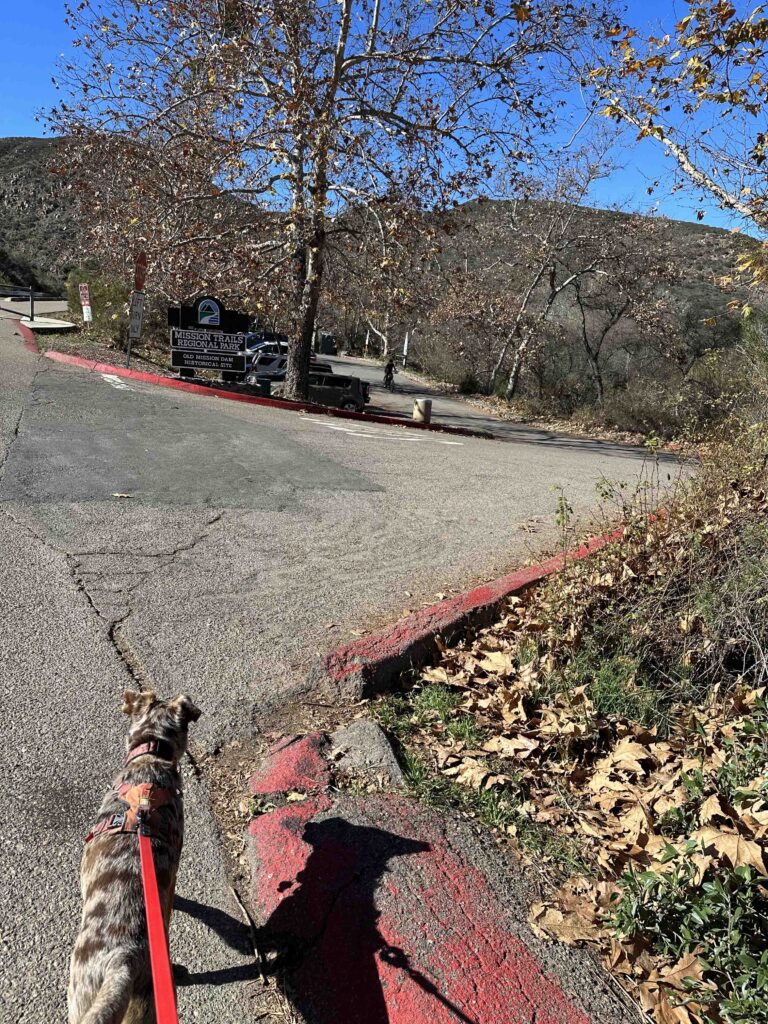
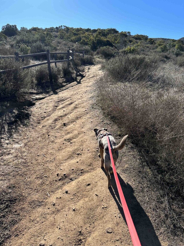
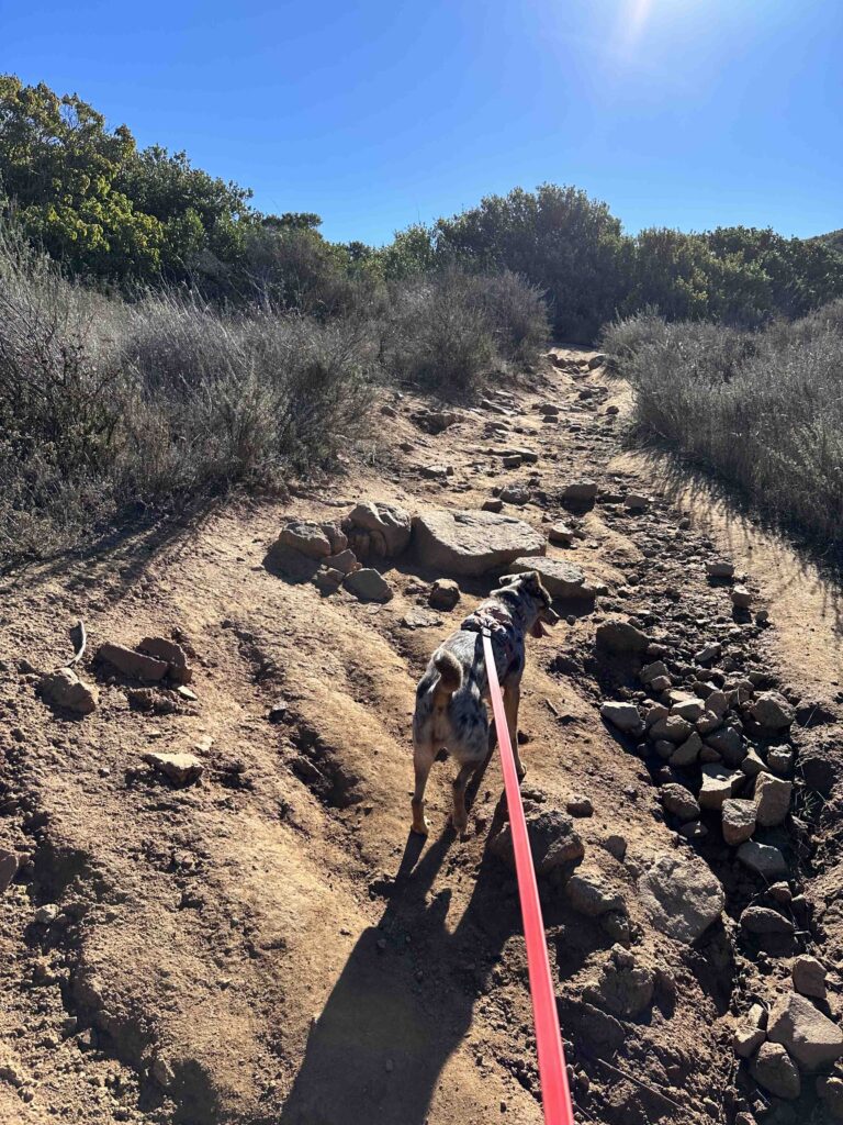
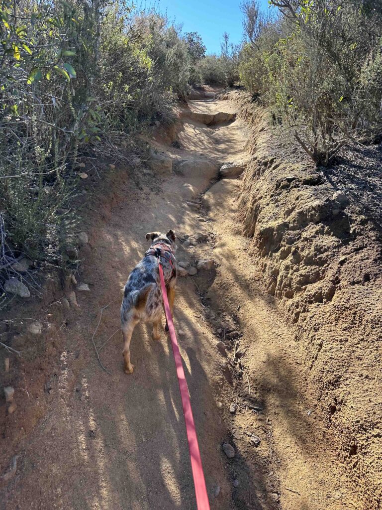
There are several entrances to the trail, but we decided to use the west trail near the Old Mission Dam. We were lucky to get the last parking spot at the Old Mission Dam parking lot across from the trail. After walking across the street to the trail entrance we started the climb. Although the trail immediately starts with an incline, it’s nothing compared to what is to come. The trail is packed dirt with rocks in a lot of areas. It’s fairly narrow, but mostly wide enough for two people to walk next to each other. There is vegetation on both sides and little shade making it a hot hike on a warm day. Luckily today was a cool morning.

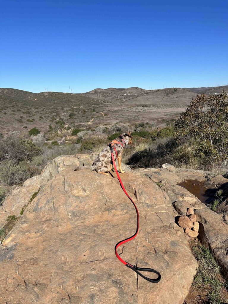
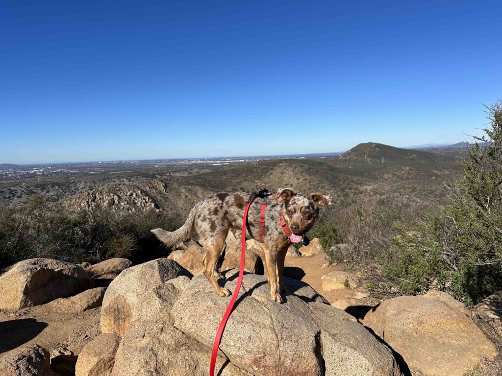
As we climbed we found some areas to stop and take in the views which are spectacular. Of course there were photo ops for Sunny who just wanted to keep hiking.

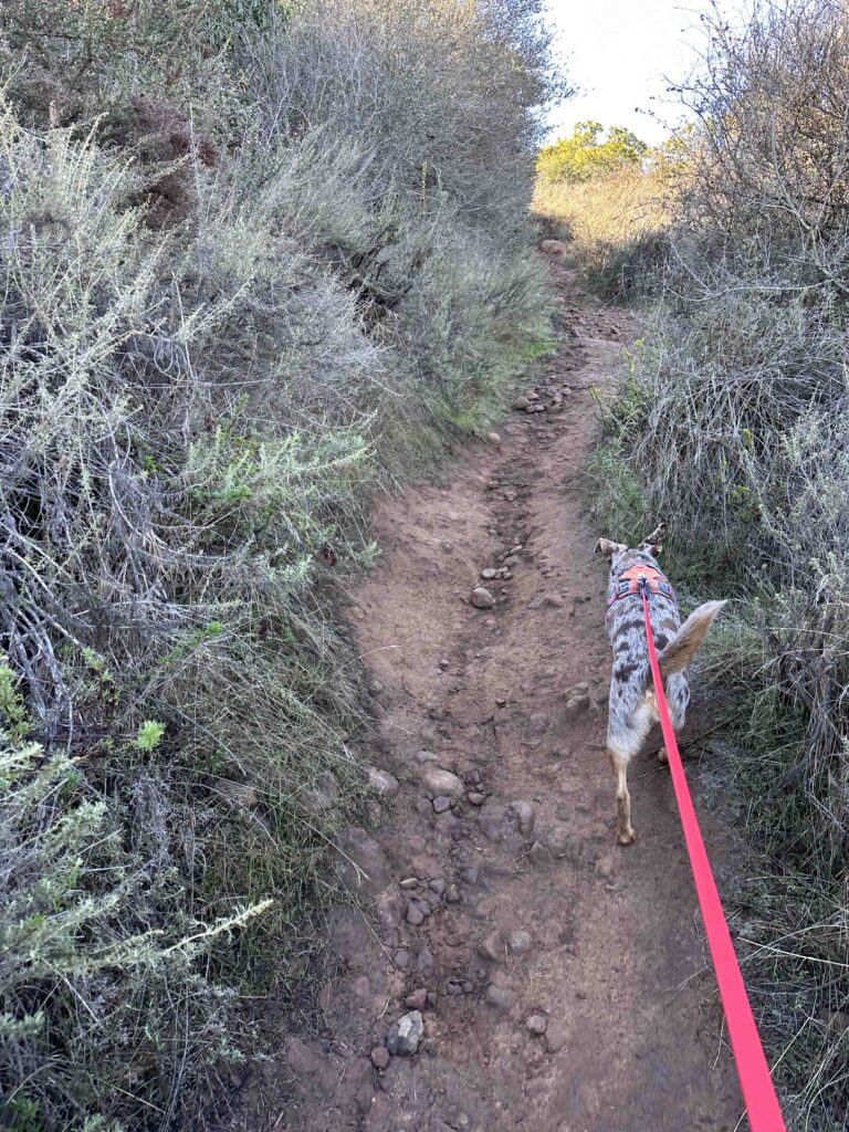
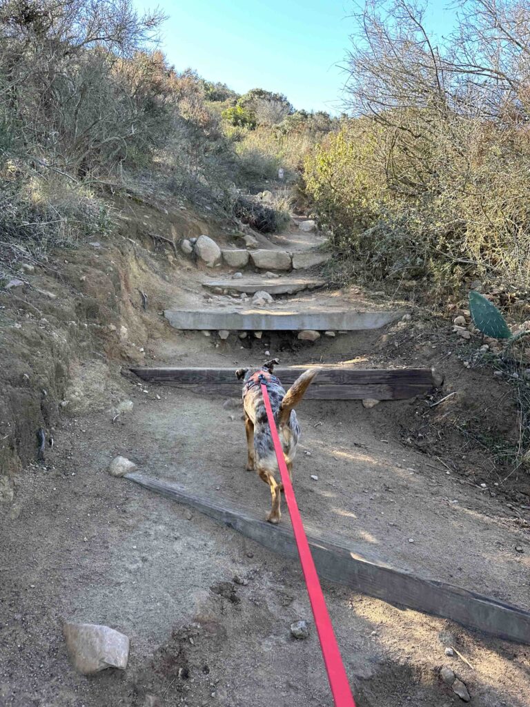
The trail is a nearly constant uphill with some sections steeper than others. Some of the inclines are covered with rocks while others have steps and stairs. The hardest part for Sunny and me were the steep steps that are not made for those with short legs. There are quite a few flights of these steps and just when you think you are done climbing, there are more steps and inclines. The steepest section of the trail are two flights of steps just prior to the summit.


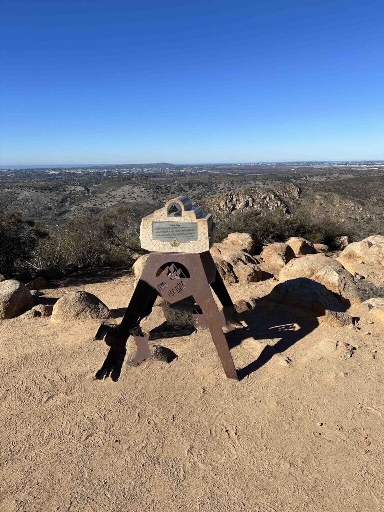
Just after conquering these stairs the trail levels off and you come to the summit and the marker. The summit provides beautiful views of the hills surrounding the area and other trails. There is also a bench and railing to rest and take in the views. After a short rest and many photographs we headed back down the trail, which was as challenging as the climb up due to the sharp descents and “slippery” dirt. Having a rambunctious young dog who likes to go fast may also have had something to do with it.

Our Rating
Sunny and I rate the Kwaay Paay Peak trail 3.5 out of 4 paws up. It’s a challenging hike within the beautiful Mission Trails Regional Park. We loved the challenge of the hills and the views at the top. The trail is well-maintained with good signage making it easy to stay on the trail. There’s ample parking both in a parking lot and on the street. The parking lot also has two porto-potties and the visitor center has a restroom. We consider Mission Trails Regional Park a must visit location in San Diego and Kwaay Paay Peak Trail a challenging hike for those who are in good shape and can handle steep inclines and descents.
For additional information about Mission Trails Regional Park check out the following websites:
Mission Trails Regional Park – History
How Do I Get There?
You can either drive to the visitor’s center, park in the lot, and walk the section of the road that is closed to vehicular traffic to the trail entrance or park at the Old Mission Dam like we did. These directions are to the Old Mission Dam parking. From CA-52 take exit #13 – Mast Blvd and turn left. After .2M turn left onto West Hills Parkway and continue for .7M. Turn right onto Mission Gorge Road and continue .2 miles. Then turn right onto Father Junipero Serra Trail and after .7M turn right into the Old Mission Dam parking lot. You can also park along the road. The trail head is located across Father Junipero Serra Trail.