
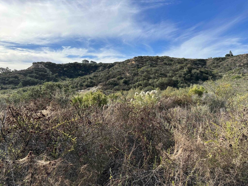
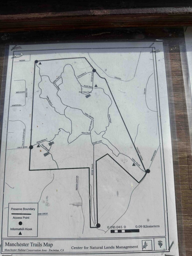
Manchester Preserve consists of 123 acres ranging from gentle slopes to steep canyon walls. There are many trails throughout the canyon with 5 different access points. The trails vary from hard-packed dirt to stones to sand. They wind down into the canyon giving views of the cliffs around you and native plants. This makes for a challenging, but beautiful hike.
I have such good memories of Manchester Preserve. Our first visit was with Karlie during COVID. We had been cooped up at home and only allowed to walk around our neighborhood when we decided to visit. Unfortunately upon arrival we found out the trails were closed. It was a great disappointment, but we returned later that year when the trails opened up and we were so happy that we did. Despite Karlie’s issues with GOLPP (geriatric onset laryngeal paralysis polyneuropathy) she was able to conquer some of the steep inclines and descents.

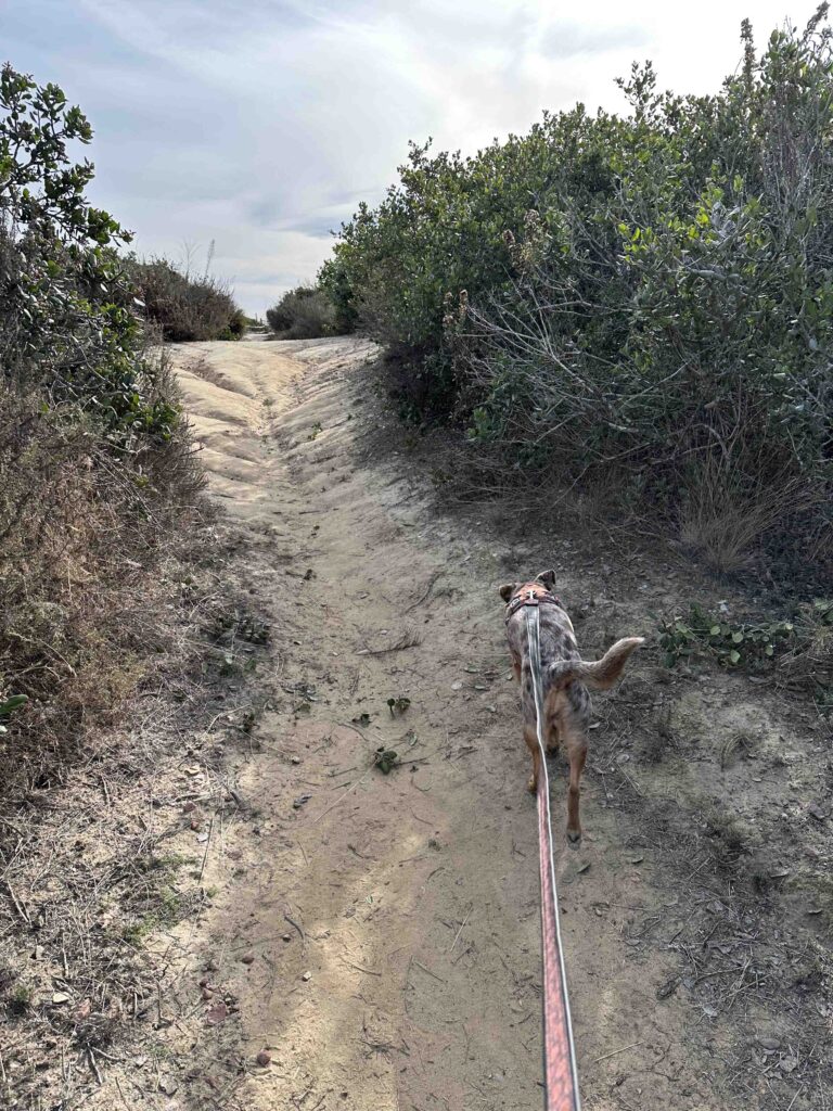
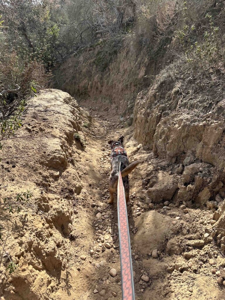
Today we took Sunny to explore the trails and we again had great fun. We took some of the same trails that we did with Karlie, but were able to go quite a bit further with Sunny. The trail starts with a small incline toward the trail map sign. From there you can go to the right or left and walk toward the canyon. Soon you come upon some steep stone steps that lead into the canyon. This is one of the hardest sections of the trail and lasts for quite awhile before coming to a narrow section carved through the stone and dirt. Eventually you come to a flatter and wider trail.


We walked along the trail for awhile and eventually found ourselves at another access point off Manchester Rd. On another day we may try starting here since there is a small parking lot. We turned around and started to head back to where we climbed into the canyon. At least that was the plan.
There are many trails and side trails through the canyon making it easy to get turned around. And to be honest that happened to us on this visit. We eventually found another access point off Taegan Lane and then used our GPS to follow the trails back to the car.
We walked just over 3M and could have walked many many more miles if we had taken all the different trails and side trails. Despite getting a little turned around we enjoyed our hike. It’s a beautiful setting with some uphill and downhill areas making it a fun, challenging hike.
Our Rating
Karlie, Sunny, and I rate Manchester Preserve 3 out of 4 paws up. There are 5 different access points, a variety of trails with beautiful views, and the trails are challenging. The downsides are no restrooms, no water features, and the trails are not marked with their names making it easy to get turned around. It also can get quite warm as there is little shade. Overall we highly recommend this trail system, but it is not for those with limited mobility or stability as the trail involves sharp inclines and descents.
How Do I Get There?
There are 5 different access points to the Manchester Preserve. We always enter at the Calle Ryan access point. From I-5 take exit #39 – Manchester Ave. Turn left onto Manchester Ave. and follow for about 1M before it turns into S. El Camino Real. Continue about .7M, then turn right onto Calle Ryan. Follow to the end and park on the street. Enter near the gate and walk up the hill toward the preserve sign.

For more information about Manchester Preserve check out the Center for Natural Lands Management and City of Encinitas websites.